Race Information
All information is subject to last minute change. However at this point the information below is believed to be final. If we have left out information below or used unfamiliar jargon please email us for clarification or about anything you would like to know that would make your Barebones more enjoyable.
Jump to:
General Information
Registration package pickup
- Before your first race you must visit the Registration Desk to pick up your race packages. At that time you must provide a signed event waiver form for each member of your group. It will not be possible to start any race before we have the signed waiver.
- Please allow plenty of time for package pickup, as there may be line-ups.
- Here is a copy of the Waiver. Everybody must sign their own copy of the waiver. You may print this off and sign it, and bring the signed copy to registration pickup.
- The Registration Desk is open Thursday evening. If at all possible, please pick up your package on Thursday to reduce waiting times.
Super important information
- Once you start a race you must always report to the finish, even if you don�t finish your course. This is to avoid us worrying unnecessarily and/or pointlessly executing our emergency search procedure.
First Aid and Emergency
- Adrian Zissos is the Barebones Event Director (cell: 403 585 8478)
- Dr Christin Lundgren is the Safety Chief
- Limited first aid is available at the finish.
- Contact Adrian Zissos or the Safety Chief in the case of serious injury or an overdue competitor.
- Whistler Health Care Clinic (4380 Lorimer Road) is open 8am - 10pm, with on-call service at other times. Phone: 604-932-4911.
- Vancouver General Hospital (899 W 12th Avenue) is open 24 hours. (6km from Stanley Park)
- UBC Hospital (2211 Westbrook Mall) is open 8am - 10pm.
- Dialing 911 will contact emergency services (police, fire, ambulance).
Competition Classes
Several competition classes are available, some age based and some 'skills & experience' based, to suit every level of navigational ability and fitness. Each class will compete on a course of the appropriate technical and physical difficult as described in the class description page.
| Championship classes (E/A/B) |
|---|
|
| Open classes |
|
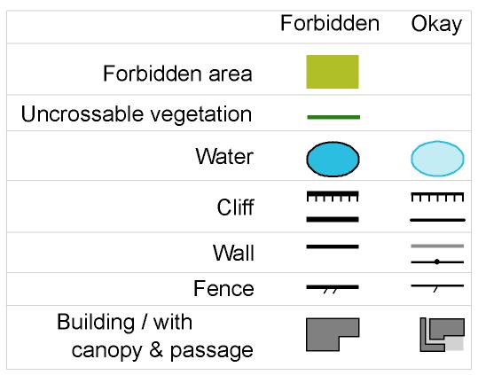
Forbidden Features
One of the attractions of Barebones 2010 is that we
have the opportunity to run in many very special places. Often these are
busy parks and we ask all participants to be on their very best
behavior, to treat all other park users with the utmost consideration
and respect, and in particular to strictly adhere to Forbidden Features
marked on the maps.
Please make sure you are familiar with the forbidden map symbols in both
ISOM & ISSOM.
|
 |
Day-prizes, Barebones 5-day awards
- Barebones day prizes: will be given in all events to the top three finishers in each E/A/B classes.
- Barebones 5-day awards: will be given to the top runner in each E/A/B class based on results from all five individual races. Scores for each race are based on finish time relative to the class winner, calculated by MTPoints using the 'Standard' method (click for details). Best four out of five results will count. Relay results do not count.
- Hint:

Western Canadian Championships (WCOC)
WCOC certificates will be awarded in each A/E class to the top eligible finishers in the three WCOC races: Brandywine (Middle distance), Whistler Village (Sprint distance), and Lost Lake (Long distance). In addition we will award any WCOC plaques that we can - all past champions, please bring the plaque to Whistler!
Eligibility for WCOC awards: Canadian citizens or Permanent Residents (as defined by the Dept. of Citizenship & Immigration) and who reside in any of Yukon Territory, BC, Alberta, Saskatchewan, or Manitoba.
World Ranking Event
The Middle distance race at Brandywine will be an IOF World Ranking Event for the M21E and W21E categories. If competing in these categories please be sure to include your WRE ID number with your registration. REMEMBER: For M21E and W21E runners only - it is not allowed to wear GPS devices for this WRE race, unless there is no display and no audible feedback.
Maps & map printing
Maps have been printed on a laser-jet or ink-jet printer. They will be in plastic bags. Legends will not be printed on the maps, but will be available on a separate sheet if you want.
Control Descriptions
Control descriptions are printed on the map. Loose copies will also be available in the start chute. All courses use IOF symbolic descriptions, in addition courses for the youngsters and open categories have loose English language descriptions available in the start chute.
Electronic timing
We�ll be using SportIdent electronic timing for all events. If you don�t have your own ePunch, pay the rental fee and borrow one at Registration. Be sure to return your rental ePunch at the end of your last event. Basic instruction on how to use the timing devices is available at the start of each race.
You will be assigned a starting time for each race. It is your responsibility to arrive at the start on-time. If you are late you will be allowed to start at a suitable time but you will be timed from your assigned start time.
It is absolutely VITAL for safety reasons that you download your ePunch at the finish following every race � whether or not you complete your course. This is the only record we have of who is safely returned from the forest.
Course Closing & Maximum times
For safety and logistical reasons each event has a course closing time (see information below). After course closing we will begin to pick up controls and search for any participant who hasn't reported to the finish (so everyone must report back to the finish by course closing time, even if you have not completed your course). Also for safety reasons each person is allowed a maximum amount of time in each event (see information below).
Complaints and Protests
At Barebones it is usually unacceptable to complain ;-) However as Barebones 2010 includes the Western Canadian Championships and an IOF-sanctioned World Ranking Event we recognize that something may go wrong with important consequences and therefore we will have the following procedure for competitors who feel something is unfair:
- Competitor files a written complaint with the organizers before the course closing.
- Organizer will consider the complaint and announce its decision.
- If the competitor is not satisfied with the decision, he or she may file a written complaint, within one hour of decision being announced. This protest should be delivered to the IOF Event Advisor.
- The event jury will announce its decision which is final.
Jury: In the case of a protest, three jury members will be chosen from:
- Dave Graupner, Manitoba, Canada
- Andree Powers, Alberta, Canada
- Brian May, BC, Canada
- Mike Minium, USA
Child minding
To assist parents & organizers with scheduling split start times, child minding will be available at the finish arena for the maximum duration of a race (3 hours). A string course and games will be set up at the child mending tent/station to amuse and challenge your young orienteers while you are competing
Event details
| Thursday July 8 | Whistler Village | Registration package pickup | |||||||||||||||||||||||||||
|---|---|---|---|---|---|---|---|---|---|---|---|---|---|---|---|---|---|---|---|---|---|---|---|---|---|---|---|---|
| Times |
|
|||||||||||||||||||||||||||
| Directions |
Aava Hotel, Whistler. Click here for Aava Hotel location map. Click here for Whistler Village tourist map |
|||||||||||||||||||||||||||
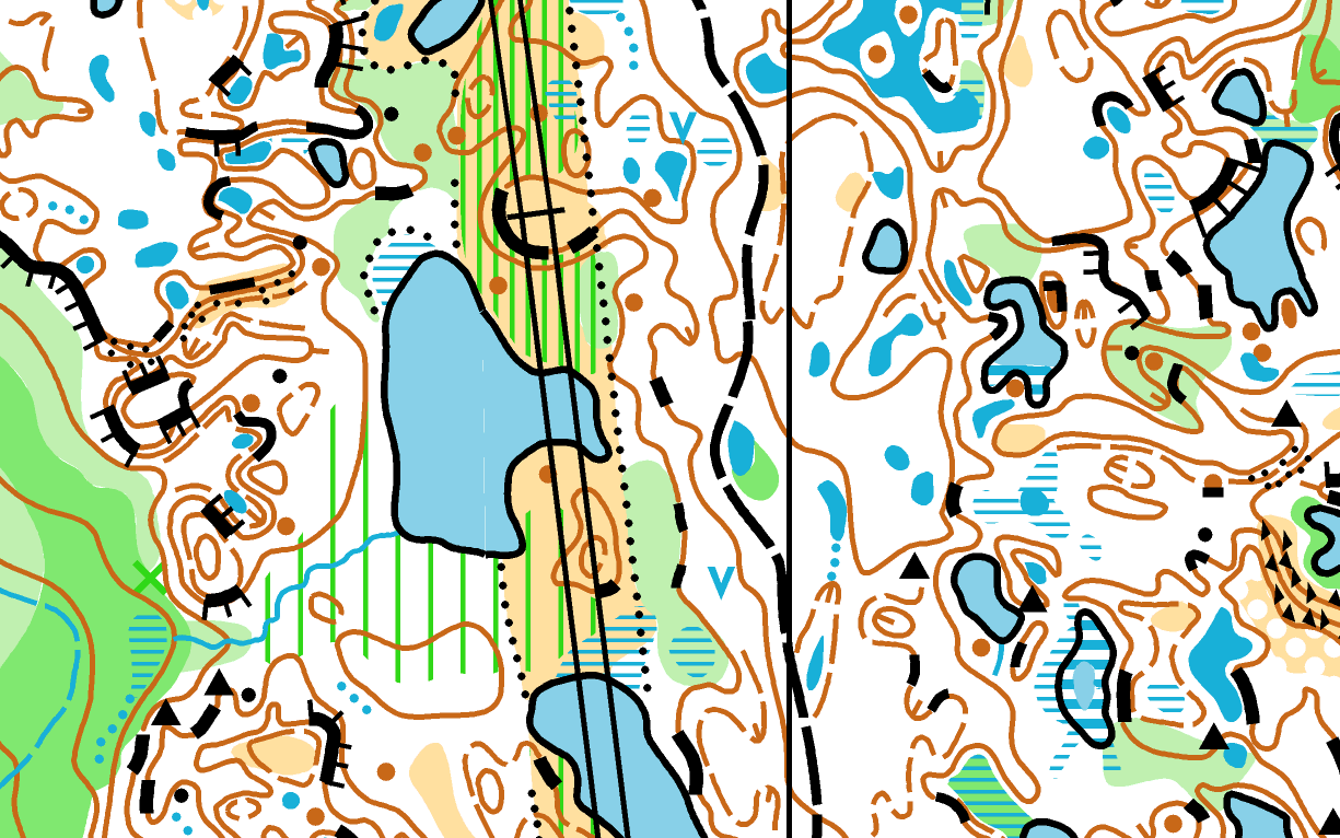
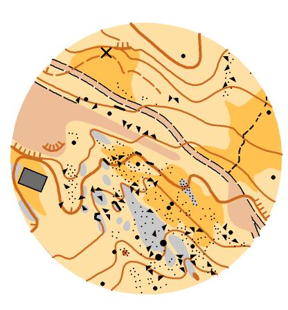
| Friday July 9 | Lost Lake | Long distance | |||||||||||||||||||||||||||
| Map |
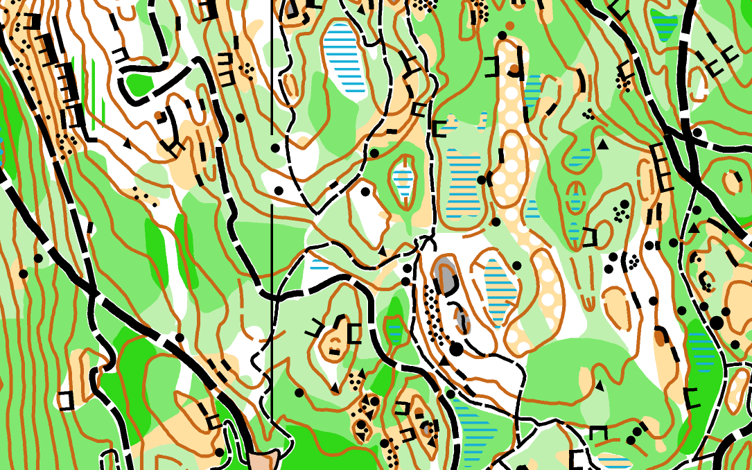 |
ISOM 1:7,500 with 4m contours Size: 8.5" X 11" Updated: October 2009: Magnus Johansson Spring 2010: Lehel Fenyoe Elevation: approx 650m Last major event: 2006 BC Champs |
||||||||||||||||||||||||||
| Terrain |
(Google Earth Image) |
A long-distance race in a challenging and rugged parkland with dense trail network. There will be plenty of route choice. There is considerable climb. Forest is variable - some sections of high speed and high visibility, other sections of dense, slow running. Lots of trails of all sizes twist throughout the park - but they rarely go straight! Fast running on the trails, with physically demanding climb. | ||||||||||||||||||||||||||
| Officials | Course planner: Dan Coombs. Controller: John Rance | |||||||||||||||||||||||||||
| Times |
|
|||||||||||||||||||||||||||
| Notes |
The area contains an intricate and steep hill in the southern part and a less complex area of small hills and valleys in the northern part. The southern hill has a lot of rock detail and a maze-like collection of paths. Competitors will need to slow down and read the map carefully in this area. There are some marshes, ponds and lakes on the map. These were mapped in April. By July they will be drier than indicated. The runnability is mixed. We have planned the courses to use the best parts of the forest, but even mapped-white forest has some fallen trees and the visibility is generally quite low. The competition map is at 1:7500 with 4 meter contours in order to capture the complexity of the southern hill which has recently been re-mapped to a high level of detail. The northern area was mapped a few years ago (with some recent updating) at lower level of detail. Competitors on the longer courses will definitely notice the transition in mapping style as they move into the northern part of the map. Almost all the trails are heavily used by mountain bikers and walkers. Please watch out for all! Longer courses go through a popular disc golf course in the north of the map. There are a few minor unmapped trails in this area and especially around the golf targets. Courses 9 (M-20A, M35, W21E) and 10 (M21E) will share a map exchange control. Please be very careful to pick up the correct new map and to dispose of your used map tidily! There will be three boxes:
Water controls will be provided on all but the shortest courses. Climb, measured on the shortest reasonable route, is about 5% of the as-the-crow-flies straight-line course length on all courses. Warm up thoroughly - the courses start up hill. |
|||||||||||||||||||||||||||
| Directions |
Click here for Whistler Village tourist map Park in the Day Lot 5. Walk past the cross-country ticket booth and follow park signs toward Lost Lake. You will find flagging as you approach Lost Lake which marks the mandatory route to the assembly area. If you are staying in Whistler Village then you can walk directly from your hotel, adding approximately 1km distance. |
|||||||||||||||||||||||||||
| Picnic on the beach | Following the race, we recommend everyone stay at the event site which is right next to the (fabulous) public beach at Lost Lake. Bring food for a picnic, or (even better), the Alpine Cafe (one of Charlotte's "Healthy Eating in Whistler" venues) runs the concession at Lost Lake beach immediately beside the Barebones finish arena. Our recommendation is to grab a home-made chicken burger from the Alpine Cafe and hang out at the beach, enjoying the great mountain evening. | |||||||||||||||||||||||||||
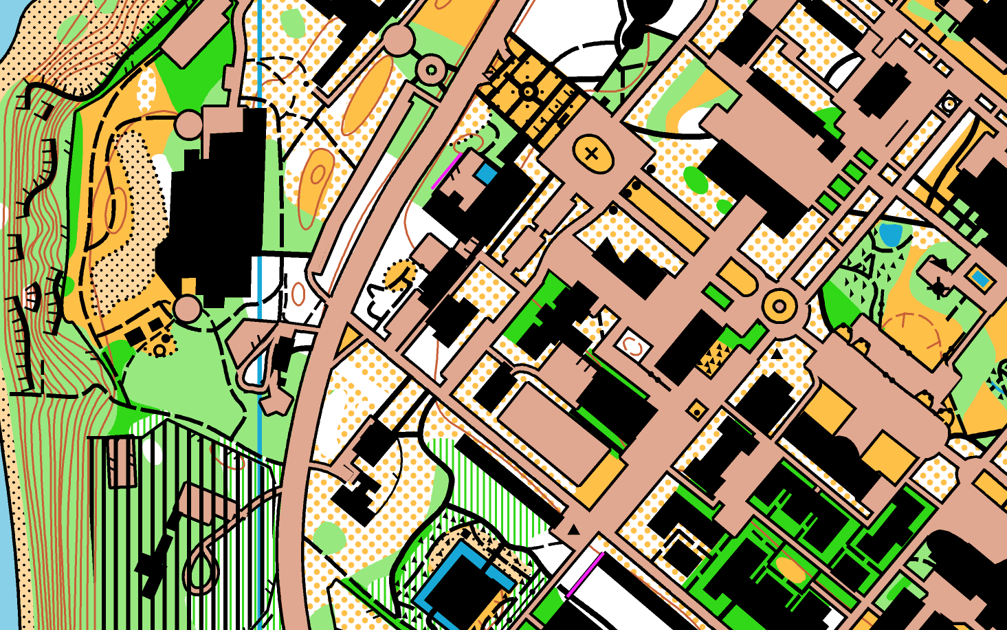
| Saturday July 10 | Whistler Village | Sprint | |||||||||||||||||||||||||||
| Map |
 |
ISSOM 1:4,000 with 2.5m contours Size: 8.5" X 11" New map. October 2009 Magnus Johansson Elevation: approx 650m |
||||||||||||||||||||||||||
| Terrain |
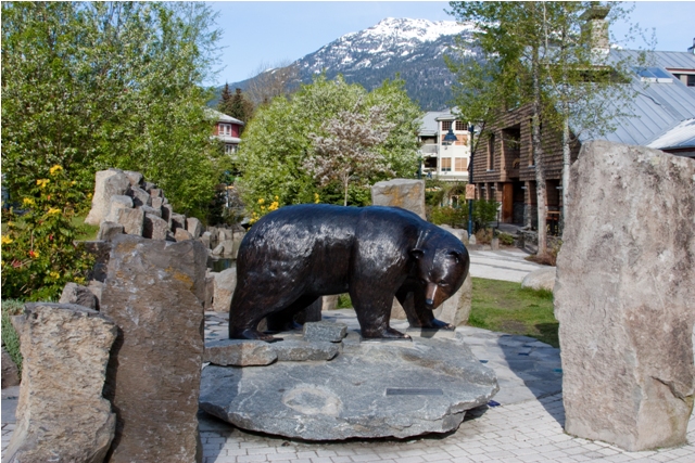 |
A very special sprint map of the complex pedestrian area of Whistler Village. Many twists and turns, lots of different levels, and many covered walk-ways. Some small sections of forest in a predominantly urban setting. Running shoes required - no metal studs allowed. | ||||||||||||||||||||||||||
| Officials | Course planners: Thomas Nipen, Louise Oram. Controller: Alex Kerr | |||||||||||||||||||||||||||
| Times |
|
|||||||||||||||||||||||||||
| Notes |
|
|||||||||||||||||||||||||||
| Quarantine |
For fairness, we ask all competitors to enter the quarantine area by
8:00am and remain there until their start time. This area is very close
to the finish and has toilets. We also ask that competitors take a direct route to the assembly area and do not "hunt" for controls before the race. |
|||||||||||||||||||||||||||
| Directions |
Click here for Whistler Village tourist map For those staying in Whistler Village, you should walk to the gazebo in Town Plaza. From there you will be directed to the quarantine area. If you are driving then park in Day Lot 4 and cross the road to the quarantine area by the municipal hall. |
|||||||||||||||||||||||||||
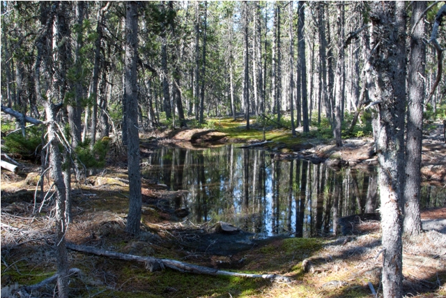
| Sunday July 11 | Brandywine Falls | Middle (WRE) | |||||||||||||||||||||||||||
| Map |
 |
ISOM 1:10,000 with 4m contours Size: 8.5" X 11" Updated May 2010 Magnus Johansson Last major event: 2006 BC Champs Elevation: approx 550m |
||||||||||||||||||||||||||
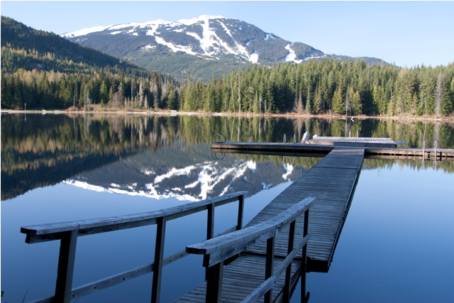
| Terrain |
 (Lava flow pond) |
Marvelous map of a relatively flat area created by ancient lava flow.
The volcanic eruptions created unique basalt formations that surround a
collection of small ponds and creates an unusually sparse dry hemlock
forest with basalt laden soil. Lots of rocks and ponds, very few trails.
Forest is a mix of quite open sections and very slow areas created by
rocky ground and/or thick undergrowth. Most of the map has uneven
footing and so we expect quite slow speeds - around 8min/km for the
elite men. |
||||||||||||||||||||||||||
| World Ranking Event | This race is sanctioned by the IOF as a World Ranking Event. Runners
in the men's and women's elite classes (M/W21E) will earn World Ranking
points. IOF World Rankings - standings IOF Event Advisor: Jan Lien REMINDER: For the M/W21E classes, in this race only, it is forbidden to wear GPS devices unless there is "no display or audible feedback". |
 Special WRE Course information:
|
||||||||||||||||||||||||||
| Officials | Course planner: Carol Ross. Controller: Alex Kerr. IOF Event Advisor: Jan Lien. | |||||||||||||||||||||||||||
| Times |
|
|||||||||||||||||||||||||||
| Notes |
|
|||||||||||||||||||||||||||
| Directions |
Parking is on the Cal-Cheak Forestry Service Road. Directions to parking from Whistler:Allow at least 30 minutes, plus 20 minutes for walk from parking to assembly area. There is no left turn onto the Cal-Cheak Forestry Service road from Highway 99, therefore you must drive all the way south to Brandywine Falls day use area, turn around there (maybe stopping for 15-20 minutes to visit the Falls), and head back north, as follows:
Directions to parking from Vancouver:Depending on your starting location, allow at least 90 minutes plus 20 minutes for walk to the assembly area. Take Highway 99 to Brandywine Falls then continue north, following directions as above. Directions from parking to the assembly area:Allow 15-20 minutes to walk from parking to assembly area. From the parking follow flagging tape through the Cal-Cheak
campsite, crossing Callaghan Creek on the pedestrian suspension bridge
and continue along the
hiking trails.
This is a scenic hike, though parts of the trail have a lot of roots to
step over. The walk is generally flat, mostly along the side of the river. |
|||||||||||||||||||||||||||
| Monday July 12 | Nester's Hill | Relay | |||||||||||||||||||||||||||
| UPDATE | Because of persistent snow, the Whistler Mountain race originally scheduled for July 12th is replaced with this Relay in the morning. The BBQ on the mountain will go ahead as planned in the afternoon. See details below. | |||||||||||||||||||||||||||
| Map |
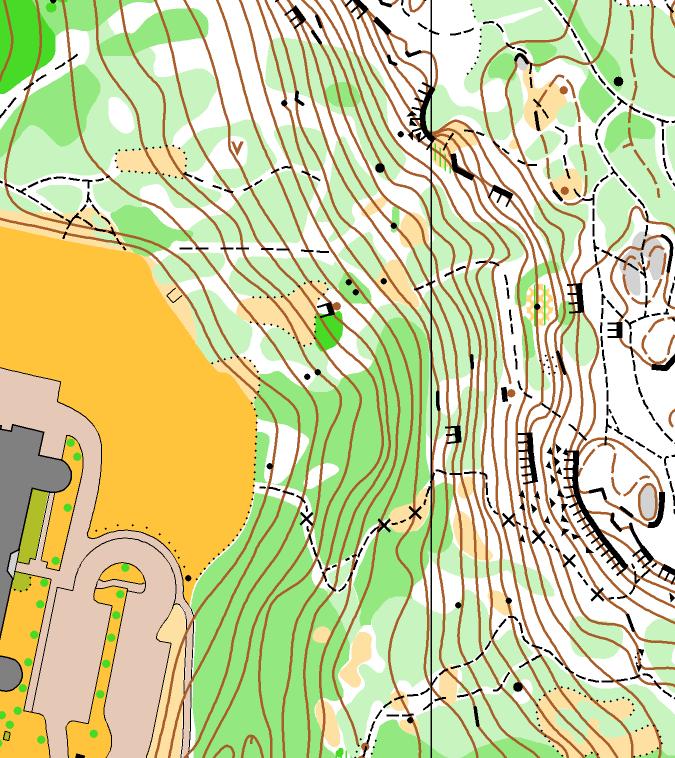 |
ISSOM Scale: 1:4,000 Contours: 2.5m Magnus Johansson, updated 2010 Elevation: approx 650m Last major event: 2006 BC Champs |
||||||||||||||||||||||||||
| Terrain | The assembly area is on the playing field beside the school. Everything goes up from there! The reward for the physically difficult climb is some lovely forest on top of the hill along with nice rock and contour detail. Relatively dense trail network, popular with mountain bikers. Forest is generally slow on the hillside and faster on top. | |||||||||||||||||||||||||||
| Officials | Course planner: Magnus Johansson. Controller: Adrian Zissos | |||||||||||||||||||||||||||
| Times |
|
|||||||||||||||||||||||||||
| Notes |
|
|||||||||||||||||||||||||||
| Relay Format |
Relay FormatThree legs, no forking. Leg difficulty is as follows:
We expect the following fastest times: Team Composition
Kids' raceThis relay is not suitable for children 14 years old and under. For these young stars we will hold a mass-start race at 8:30am. There will be two courses based on the regular age groups. The courses will be in the vicinity of the school and will allow for lots of cheering. Non-relay optionIf you really, absolutely, definitely don't want to take part in the relay (which would be a tragic decision ;-) we will have a number of extra Leg 1 maps prepared. Report to the special area close to the start line at 8:50am. You will be part of the mass start - to make a big spectacle! Relay tips - mass starts & followingTo prepare for the chaos of the mass start you must do lots of mental preparation so that you are able to focus on your own navigation and not be distracted by others. To help with this mental preparation, here are two video clips from the absolutely massive Jukola relay ... Video One and Video Two (warning: these take a while to download, but they are worth it). Following: While following is generally frowned upon in orienteering (actually it is quite against the rules), an exception is made for relays. In fact a lot of the fun of running in a relay is being in a "train" - moving together with other runners much faster than you would if you were alone.
|
|||||||||||||||||||||||||||
| Directions |
The event center is at Myrtle Philip School, on Lorimer Road west of Highway 99. View a Whistler map. There is no parking allowed at the event center � all the parking is reserved for other school users. We have been granted permission to use this area only if all participants walk from Whistler Village. Please do not cause trouble by attempting to park at the school or in the surrounding residential areas. If driving to Whistler: If walking from Whistler Village: |
|||||||||||||||||||||||||||
| Toilets |
Inside the school. Enter from the north side of school. Do not use the school's front entrance. Remove shoes when you go inside. There is a room inside if the weather is bad. Please do not make a mess in the school - and we are looking for volunteers to help sweep / mop the floors when we leave |
|||||||||||||||||||||||||||
| Monday July 12 | Whistler Mountain | BBQ | |||||||||||||||||||||||||||
| UPDATE | Although the race on the mountain has been cancelled. the social BBQ and sightseeing is going ahead as planned. | |||||||||||||||||||||||||||
| BBQ |
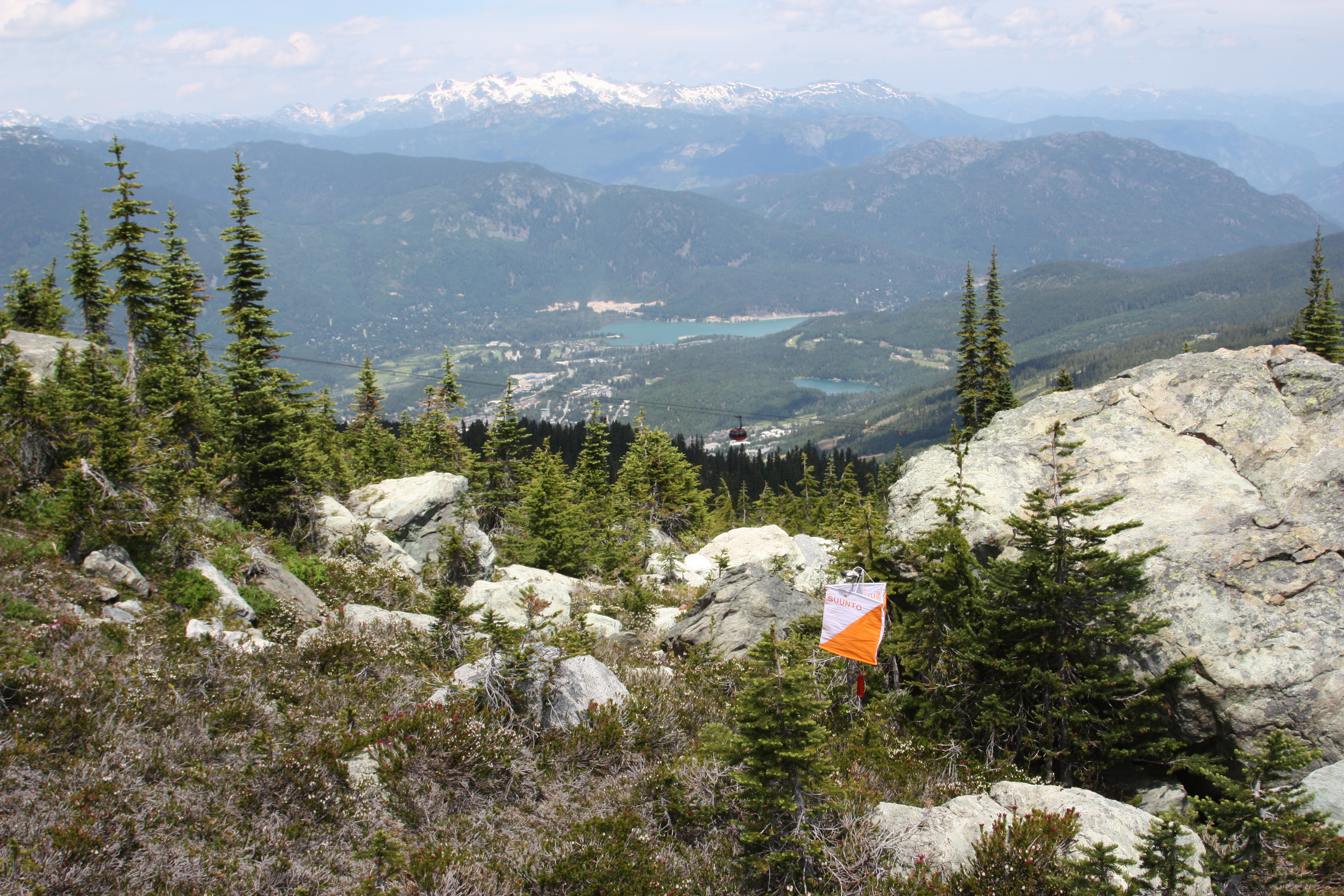 |
Take the gondola from Whistler Village up to the Roundhouse and enjoy
a nice BBQ and some incredible sightseeing in very special alpine
terrain. |
||||||||||||||||||||||||||
| Map |
 |
Generally rocky ground with great variety of terrain. But you'll just
have to take our word for it ;-)
Persistent
snow covers the map. We are very disappointed to have cancelled this race. However as a small consolation we will give out the race maps at the BBQ. |
||||||||||||||||||||||||||
| Times |
|
|||||||||||||||||||||||||||
| Notes |
|
|||||||||||||||||||||||||||
| Directions |
Take the Whistler Gondola all the way to the top. Get off at the
top, at the Roundhouse. The BBQ is in the Glacier View Room Click here for Whistler Village tourist map showing where to get onto the gondola. |
|||||||||||||||||||||||||||
| BBQ | You must pre-purchase your BBQ ticket using the online registration. There will be no last minute tickets available as we must provide the catering company with final numbers well in advance of the day. It is possible to buy as many BBQ tickets as you wish. | |||||||||||||||||||||||||||
| Sightseeing & hiking |
Your gondola ticket gives you access on the day to all of the lifts running on
both Whistler and Blackcomb mountains, and on the
Peak2Peak gondola that connects the two mountains. Because of the unseasonably cold weather we expect only a few of the chair lifts to be running. But the Peak2Peak gondola will be running and we highly recommend you enjoy a round trip from Whistler Mountain to Blackcomb Mountain and back. Maybe stop on Blackcomb and see if you can find some gelatto. Click here for a map of the summer-time mountain lifts and gondolas. |
|||||||||||||||||||||||||||
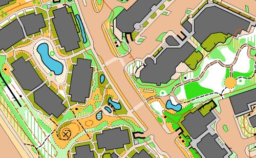
| Tuesday July 13 | Vancouver | Stanley Park | Long/Sprint fusion | |||||||||||||||||||||||||||
| Map |
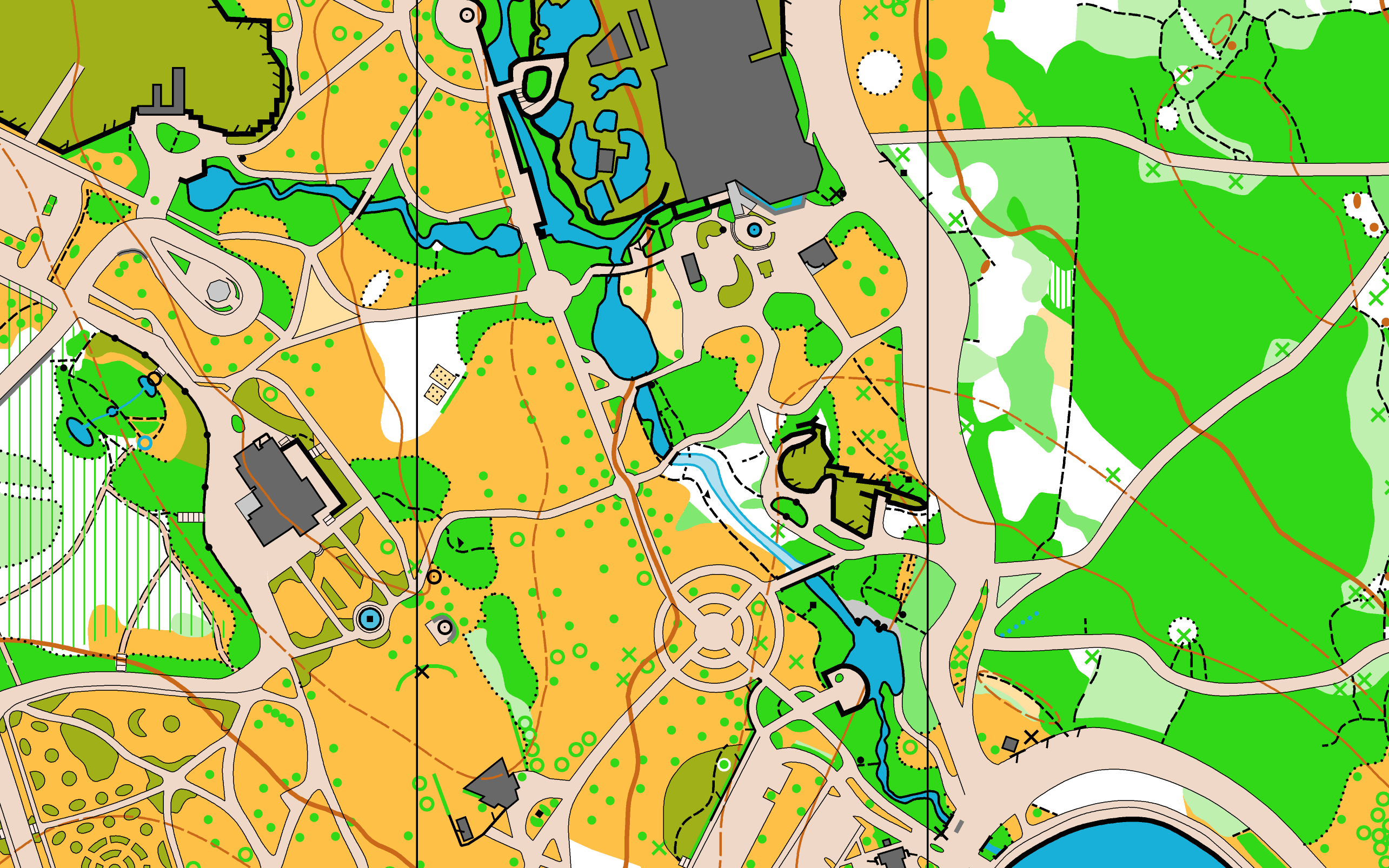 |
ISSOM 1:5,000 with 5m contours Size: 17" X 11" Elevation: sea level |
||||||||||||||||||||||||||
| Terrain |
Totem poles in Stanley Park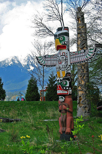 Photo: p.m.graham |
A very long sprint-style race on a sprint-standard map, visiting the totem poles, the beluga whales (watch video), Coal Harbour, and many other fabulous spots in Vancouver�s iconic park. The courses are designed to show off the scenic wonders of one of the world's great urban parks and we hope they will bring a smile to your face as you navigate through this special place. |
||||||||||||||||||||||||||
| Officials | Course planner: Meghan Rance. Controller: John Rance | |||||||||||||||||||||||||||
| Times |
|
|||||||||||||||||||||||||||
| Course Notes |
This race takes part in one of Vancouver's busiest parks. Please be especially courteous to other park users. In particular:
SportIdent card issues:
|
|||||||||||||||||||||||||||
| Directions |
The assembly area is at Lumbermen's Arch in Stanley Park, 200 meters north of the Aquarium (see the Tourist maps below,
check inset "B - around the aquarium").
Park on the roadway west of Lumberman's Arch.
There are toilets and a concession at Lumbermen's Arch.
Directions to Stanley Park from Whistler:Allow at least 120 minutes. Take Highway 99 south from Whistler and enjoy approximately 90 minutes of stunning scenery, including a wonderful drive along the cliff-shores of Howe Sound. When you reach Horseshoe Bay, stay on Highway 1 and take Exit 13 onto Taylor Way. Follow the signs to Vancouver and cross over the Lions Gate bridge into Stanley Park.
Follow the remaining directions on the tourist map below. |
|||||||||||||||||||||||||||
| Tourist map |
Here are a map and guide showcasing Vancouver's premier park, highlighting Stanley Park's status as one of the great urban parks of the world. The map and guide offers key information on activities, attractions, history, forest and wildlife, hidden gems and more. Information about restaurants, the Seawall, the Children's Farmyard, Miniature Railway, Aquarium and other attractions will help you plan your visit to this exceptional, 1000 acre park located next door to bustling downtown Vancouver.
Download Stanley Park Map + Guide
Download Stanley Park Map |
|||||||||||||||||||||||||||
| Wednesday July 14 | Vancouver | UBC | Sprint x 1.5 | |||||||||||||||||||||||||||
| Map |
 |
ISSOM 1:5,000 Elevation: Sea level |
||||||||||||||||||||||||||
| Terrain | This will be a 1.5 X sprint length course through the beautiful
ocean-side campus of the University of British Columbia. |
|||||||||||||||||||||||||||
| Officials | Course planners: Jeremy Gordon, Andy Reddin. Controller: Brian Ellis | |||||||||||||||||||||||||||
| Times |
|
|||||||||||||||||||||||||||
| Quarantine | For fairness, we have designated that all areas of the University west of Westbrook Mall are out of bounds on Wednesday morning - other than the path between the North Parkade and McInnes Field, and access to the toilets in the SUB and Student Rec buildings. | |||||||||||||||||||||||||||
| UBC Notes |
UBC is a delightful and large campus with many UBC attractions in including:
|
|||||||||||||||||||||||||||
| Directions |
The assembly area is at McInnes Field. Parking is adjacent to the assembly area in the "North Parkade".". Cost is $1.75/30 minutes (ouch) to a maximum of $13. Turn off Westbrook Mall into Student Union Blvd. To reach the assembly area from the parkade, head south-east across Student Union Blvd to the large grassy field. Alternative parking is available for a flat-fee of $5.50 at Westbrook Mall and Agronomy Road, by the "Thunderbird Parkage". If you park here, you must walk north along Westbrook Mall to the assembly area. All parts of the university west of Westbrook Mall are out of bounds. |
|||||||||||||||||||||||||||

Course Lengths
Column descriptions:
- TD - technical difficulty (see the class description page for details).
- For each event, course distance (km) measured along the as-the-crow-flies straight route
| Class | Age | TD | Lost Lake | Whistler Village |
Brandywine | Whistler Mountain |
Stanley Park |
UBC |
|---|---|---|---|---|---|---|---|---|
| km | km | km | km | km | km | |||
| M-10A | 10 & under | 1 | 1.7 | 1.2 | 1.5 | 1.3 | 2.0 | 1.9 |
| M-12A | 12 & under | 1 | 1.7 | 1.2 | 1.5 | 1.3 | 2.0 | 1.9 |
| M-14A | 14 & under | 2 | 2.3 | 1.2 | 1.8 | 1.7 | 2.0 | 1.9 |
| M-16A | 16 & under | 3 | 3.2 | 2.5 | 1.7 | 2.6 | 7.5 | 4.3 |
| M-20A | 20 & under | 5 | 8.0 | 2.9 | 3.7 | 4.8 | 10.0 | 4.9 |
| M21E | All | 5 | 10.2 | 2.9 | 4.2 | 5.2 | 10.0 | 4.9 |
| M35 | 35 & over | 5 | 8.0 | 2.9 | 3.7 | 4.8 | 10.0 | 4.9 |
| M45 | 45 & over | 5 | 6.2 | 2.9 | 2.7 | 2.9 | 10.0 | 4.9 |
| M55 | 55 & over | 5 | 4.8 | 2.0 | 2.4 | 3.2 | 6.4 | 3.9 |
| M65 | 65 & over | 5 | 3.7 | 2.0 | 2.3 | 2.9 | 6.4 | 3.9 |
| M75 | 75 & over | 4 | 2.5 | 1.4 | 1.5 | 1.6 | 4.1 | 3.2 |
| M80+ | 80 & over | 4 | 2.5 | 1.4 | 1.5 | 1.6 | 4.1 | 3.2 |
| M-12B | 12 & under | 1 | 1.7 | 1.2 | 1.5 | 1.3 | 2.0 | 1.9 |
| M-14B | 14 & under | 1 | 1.7 | 1.2 | 1.5 | 1.3 | 2.0 | 1.9 |
| M-16B | 16 & under | 2 | 2.3 | 1.4 | 1.8 | 1.7 | 4.1 | 3.2 |
| M-20B | 20 & under | 5 | 3.2 | 1.4 | 1.7 | 2.6 | 4.1 | 3.2 |
| M21B | All | 4 | 4.8 | 2.0 | 2.4 | 3.2 | 6.4 | 3.9 |
| W-10A | 10 & under | 1 | 1.7 | 1.2 | 1.5 | 1.3 | 2.0 | 1.9 |
| W-12A | 12 & under | 1 | 1.7 | 1.2 | 1.5 | 1.3 | 2.0 | 1.9 |
| W-14A | 14 & under | 2 | 2.3 | 1.2 | 1.8 | 1.7 | 2.0 | 1.9 |
| W-16A | 16 & under | 3 | 3.2 | 2.5 | 1.7 | 2.6 | 7.5 | 4.3 |
| W-20A | 20 & under | 5 | 6.2 | 2.5 | 2.7 | 2.9 | 7.5 | 4.3 |
| W21E | All | 5 | 8.0 | 2.5 | 3.7 | 4.8 | 7.5 | 4.3 |
| W35 | 35 & over | 5 | 6.2 | 2.5 | 2.7 | 2.9 | 7.5 | 4.3 |
| W45 | 45 & over | 5 | 3.7 | 2.0 | 2.3 | 2.9 | 6.4 | 3.9 |
| W55 | 55 & over | 5 | 3.3 | 1.4 | 1.8 | 2.8 | 4.1 | 3.2 |
| W65 | 65 & over | 4 | 2.5 | 1.4 | 1.5 | 1.6 | 4.1 | 3.2 |
| W75 | 75 & over | 4 | 2.5 | 1.4 | 1.5 | 1.6 | 4.1 | 3.2 |
| W80+ | 80 & over | 4 | 2.5 | 1.4 | 1.5 | 1.6 | 4.1 | 3.2 |
| W-12B | 12 & under | 1 | 1.7 | 1.2 | 1.5 | 1.3 | 2.0 | 1.9 |
| W-14B | 14 & under | 1 | 1.7 | 1.2 | 1.5 | 1.3 | 2.0 | 1.9 |
| W-16B | 16 & under | 2 | 2.3 | 1.4 | 1.8 | 1.7 | 4.1 | 3.2 |
| W-20B | 20 & under | 5 | 3.2 | 1.4 | 1.7 | 2.6 | 4.1 | 3.2 |
| W21B | All | 4 | 3.7 | 2.0 | 2.3 | 2.9 | 6.4 | 3.9 |
| TR1 - Open Beginner | All | 1 | 1.7 | 1.2 | 1.5 | 1.3 | 2.0 | 1.9 |
| TR 2 - Open Beginner Plus | All | 2 | 2.3 | 1.4 | 1.8 | 1.7 | 4.1 | 3.2 |
| TR3 - Open Intermediate | All | 3 | 3.2 | 2.0 | 1.7 | 2.6 | 6.4 | 3.9 |
| TR 4 - Open Advanced | All | 4 | 2.5 | 2.5 | 1.5 | 1.6 | 7.5 | 4.3 |
| TR 5 -Open Expert | All | 5 | 3.7 | 2.9 | 2.3 | 2.9 | 10.0 | 4.9 |
| Adventure Run | All | All | 2.9 | 10.0 | 4.9 |